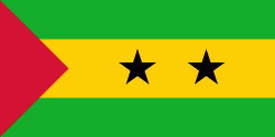
Cantagalo District (Cantagalo District)
Cantagalo is a district of São Tomé and Príncipe, on São Tomé Island. Its area is 119 km2, and its population is 17,161 (2012). The district seat is Santana. It is divided into the two statistical subdistricts Santana and Ribeira Afonso.
Map - Cantagalo District (Cantagalo District)
Map
Country - São_Tomé_and_Príncipe
 |
 |
It consists of two archipelagos around the two main islands of São Tomé and Príncipe, about 150 km apart and about 250 and 225 km off the northwestern coast of Gabon. With a population of 201,800 (2018 official estimate), São Tomé and Príncipe is the second-smallest and second-least populous African sovereign state after Seychelles.
Currency / Language
| ISO | Language |
|---|---|
| PT | Portuguese language |


